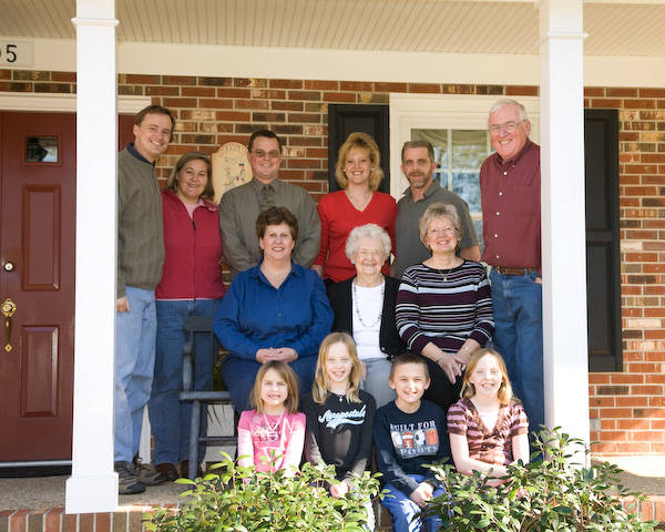
March 1, Saturday
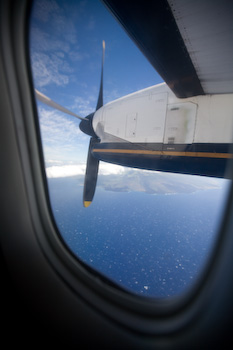
March 8, SaturdayDay one of our month long trip to Hawaii and Australia. Everyone is excited and everyone did well on the 5 hour flight from Washington Dulles to Los Angeles and another 5 hours to Honolulu. Betsi and I remember how we felt when we did this last time in August 2000 and spent the night at an airport hotel. We'll catch a morning flight to the Big Island.
March 9, Sunday, Hilo, Hawaii (east central Big Island)
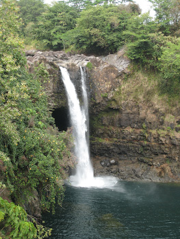
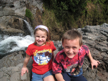
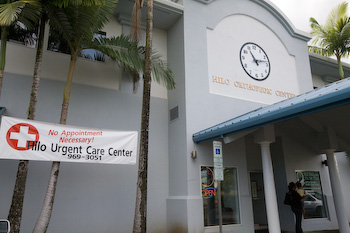
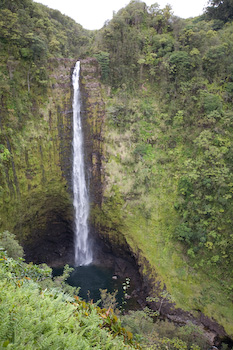
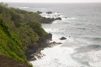
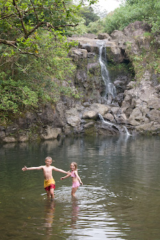
While Jeff spent the three hours at the urgent care center, Betsi and the kids visited Rainbow Falls (shown) and swam at the Boiling Pots further upstream. In the morning when the sun is behind you, a rainbow is visible, but these were taken in the afternoon. March 10, Monday - Hilo, Hawaii (east central Big Island)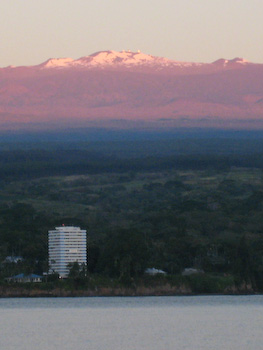
Betsi saw the snow covered mountaintop of Mauna Kea during her morning jog and came back to the room to grab her camera. It's almost 14,000 feet tall (4,500m). Both of these photos include Hilo Bay.
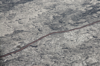
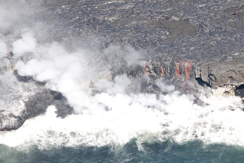
A river of lava heads for the coast on the left, goes underground, and cascades over the cliff on the right. The heat above the hot, crusted, black lava made the helicopter ride suddenly warmer when we flew over it. 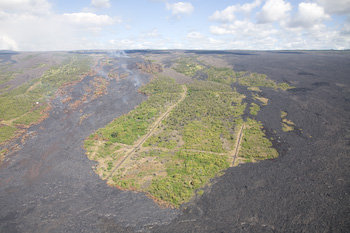
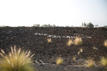
A prior lava flow covers the remains of a deserted neighborhood on the left. The Kilauea crater steams sulfur dioxide gas. Our altitude and helicopter rotors dissipated the odor. 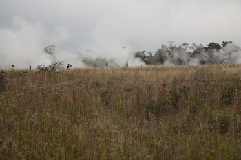
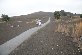
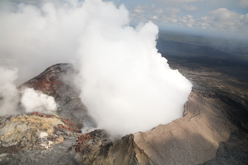
A number of steam vents on the ground (left) along the 11 mile drive around the Kilauea Caldera on Crater Rim Drive 4,000 feet (1,300m) above sea level. On Devastation Trail (right), plant life is starting to return to this once barren land of a prior lava flow. An observation area further down the road closed due to the high levels of sulfur dioxide gas. It reminded us that volcanic areas are dangerous places and conditions continually change.

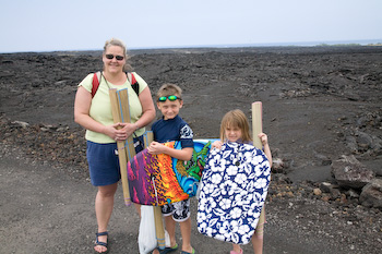
We heard on the radio that the lava stopped flowing, but we traveled along highway 130 to the new viewing spot anyway. We were totally unprepared. We were supposed to wear pants, gloves, and closed toe shoes and carry water and a flashlight. Because the trip was a last minute decision, we didn't have any of those things. People took pity on us. We managed to park two miles closer because of the kids. It was a rugged, dusty dirt path that saved us about 45 minutes of walking. A couple gave us a large flashlight and we "piggybacked" off of other people's flashlights. We were part of a mile long line of flashlights hiking over the uneven lava rocks to get to the viewing area. Our reward was two lava streams flowing into the boiling ocean about a mile away. The intensity of each flow changed from minute to minute. On the way back, we saw lava flowing down the hillside, but it wasn't as dramatic as this photo. The photo isn't as clear was what we could see. The five second exposure blurred the rising steam plumes. March 11, Tuesday - Driving around north end of the Big Island from Hilo to Kailua-Kona, Hawaii
March 12, Wednesday - Kailua-Kona, Hawaii (west central Big Island)
March 13, Thursday - Kihei, Hawaii (south central Maui)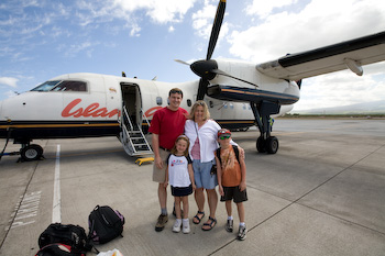
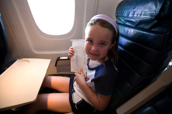
Our de Havilland Dash 8 from Kona (Big Island) to Kahului (Maui). Ainsley has been writing, "We hope you feel better soon" on all of the sick bags she could find. She then colors hearts around the words.
March 14, Friday - Road to Hana (northern Maui)
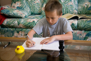
Ainsley gets caught up with writing postcards to the grandparents and her friends. Ryan writes in his journal with a duck from his teacher and a souvenir Tiki. View Larger Map The Hana Highway starts in Kahului near the airport, hugs the coast for half of the 16 miles, changes from highway 36 to 360, the mile markers reset to zero, and hug the coast for most of the additional 32 miles to the Hana airport. The town of Hana is only two miles away before changing to highway 31 and the mile markers start counting down from 51. The road was closed after mile marker 38 on the gravel section that is sometimes washed away. It was an unforgettable 63 miles. 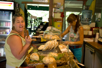
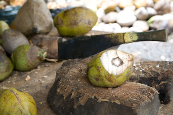
The woman at the roadside stand slices our first loaf of banana bread. It was great. The other stand sold fresh coconuts and coconut juice. 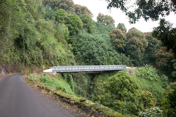
The two lane road to Hana was often 1.5 lanes wide around turns and approaching any of the dozens of one-lane bridges. "Exciting" would be one way to describe the 50 mile drive. 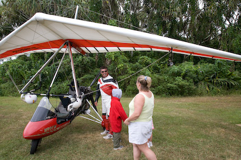
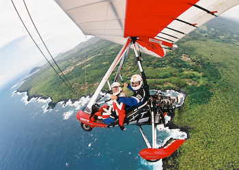
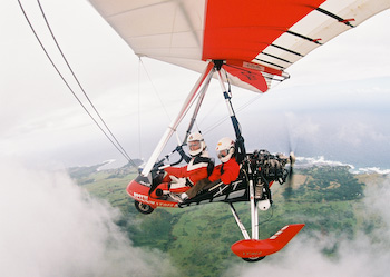
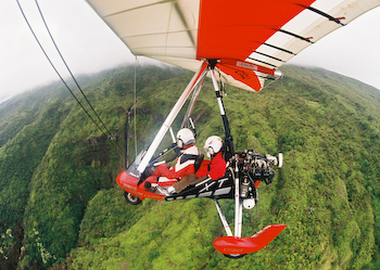
Jeff (blue suit) and Ryan (red jacket) flew as back seat passengers on a powered glider ride in Hana with Armin. Armin had a 35mm film camera mounted on the underside of the wing. We saw a waterfall (bottom right) and flew above the clouds (bottom left). Armin turned off the motor while flying around the clouds and we glided the rest of the way to the airport. Watch the video of Ryan's impressions (2:08, 9.5MB).
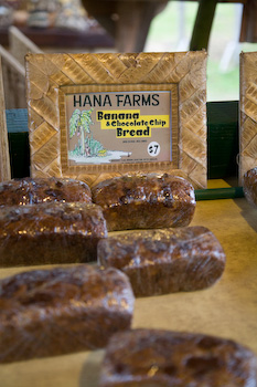
Banana bread was a common item for sale at the roadside stands. We tried three different loafs from different places and all of them were outstanding. The one above is banana and chocolate chip for $7 a loaf. 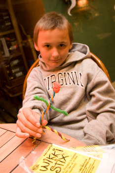
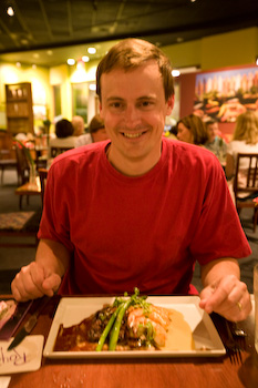
Ryan plays with colored wax strands before dinner arrives. Jeff was hungry and ate one of the two fish tacos. The fresh pieces of fish fillet taste so much better than deep fried fish pieces that we've had on the mainland. Jeff's hunger let him believe the town of Pa'ia was in the middle of the 50 mile road to Hana instead of at the beginning. Twenty miles going 20mph on a curving road makes the hour drag by. March 15, Saturday - Napili and Lahaina (western Maui)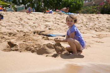
Having fun at Napili Beach. The kids met other kids their age and had fun with the boogie boards. Guess who slept in the car ride home after dinner?
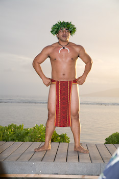
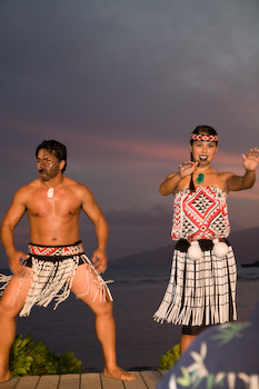
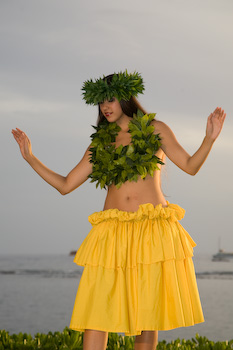
Some of the costumes at the luau with the sunset and island of Lanai in the background. 
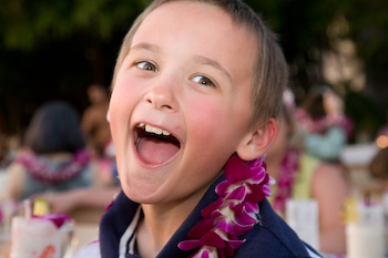
The kids making silly faces. March 16, Sunday - Road to Hana (northern Maui)
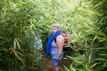
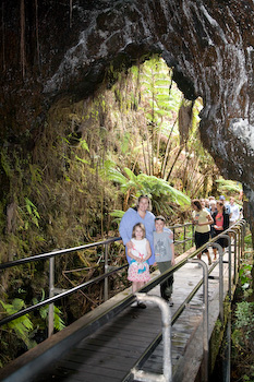
The entrance to the four falls of Na'ili'ili-Haele is 1 and 6/10 miles past mile marker 5 (number 6 is missing) on highway 360. There aren't any signs and the opening to the trail is barely two feet wide (2/3 meter) between some bamboo trees. 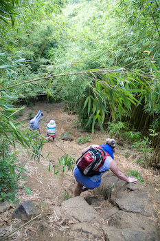
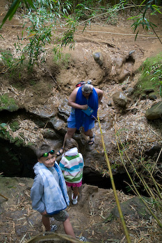
Betsi and the kids carefully make their way down a hill (left) to cross a crevasse (center) to reach the first waterfall (right). 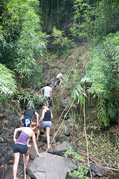
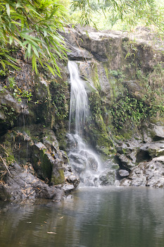
After a few unsuccessful attempts, Ryan is the first one of us to use a fallen bamboo tree as a rope to scale up the wet and muddy rock about 12 feet high. We made it to the second waterfall above. We never made the third and fourth waterfall as it required climbing up a 10 foot rock face.
March 17, Monday - western Maui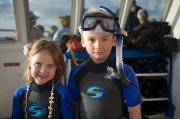
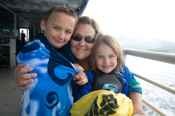
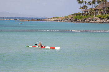
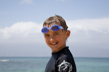
We left the dock at 7:00am on the Quick Silver catamaran for a five hour snorkel and whale watch tour. The kids practiced with snorkels and fins over the summer at the pool, which made it easier for them on this trip. Ainsley liked the boogie board with a cutout window for viewing the fish and coral better though. On the second stop, we saw two sea turtles swimming around. We rented wetsuits, which turned out to be a smart move. The water felt warm, but after an hour in the water at each stop, your body can't maintain the proper temperature. 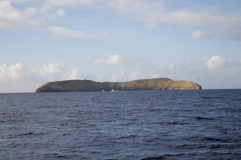

We head toward the crescent moon shaped Molokini Crater for our first snorkel stop. This is the only part of the trip thus far we wished we remembered to bring the underwater housing for Betsi's digital camera. It's collecting dust on the dining room table in Virginia. The water was as clear or clearer than Caribbean waters because it blocked the ocean current. Along the way, we spotted a few whales with their calves. Many have already left for their 3,000 mile (5,000km) journey to Alaska. The peak time to see them this year was the last few days of February.
March 18, Tuesday - Wailea (southwestern Maui)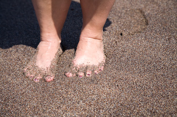
We had to visit the Black Sand Beach. There are many across Hawaii. The sand was not any hotter than a white sand beach, but the sand was courser. 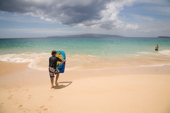
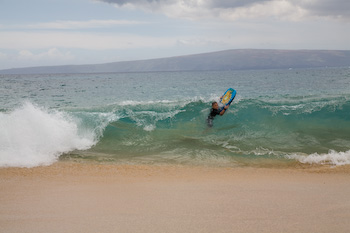
Ryan battles the surf on Big Beach. During our snorkel cruise, the crew talked about Big Beach and neighboring Little Beach. Betsi and I weren't really paying attention. Ryan asked to go see Little Beach, but we thought the cliff separating the two beaches would stop him and he'd come back 10 minutes later. Twenty minutes passed and Jeff went to check on him only to meet him near the base of the hill, which looked like a cliff from the distance. Ryan wanted Jeff to come with him to see something, but as soon as we see it, Jeff would want to leave. Jeff asked if the other beach was a nude beach and Ryan sheepishly answered yes. They immediately turned around and headed back to Betsi and Ainsley. Ryan said he knew everything there was to know and he even saw two people cuddling. Great. There is goes twenty minutes of images permanently burned into his memory. Betsi and Jeff sort of remembering a comment about a nude beach, but it was mostly guys. Ryan said there were more girls than boys. 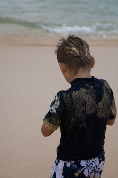
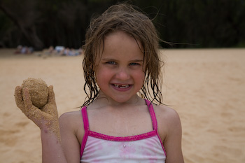
The sand and water were sticky enough to make a sand ball. Jeff has never seen that before. We went back to the condo, took showers, and flew to Honolulu around 7:30pm for an overnight before our morning flight to Sydney. |